It was a blast. The views from the ridge were spectacular and the climbing was not too difficult. Even the much-ballyhooed knife edge near the summit (which many guides consider 4th class) was not nearly as hard as I'd thought.
The trailhead is located several miles up a (comically) steep and rocky dirt road from I-70 exit 221 (Bakerville). Both mountains are very crowded in the summer. Taking the ridge instead of the trail is a great way to dodge crowds.
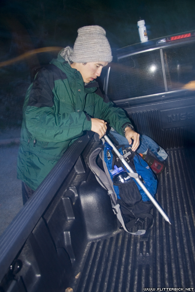
Packing up and leaving after a night in the truck bed.
- 17 June 2006
- Canon Rebel XT
- 3.2s f/4.0 at 22mm iso200
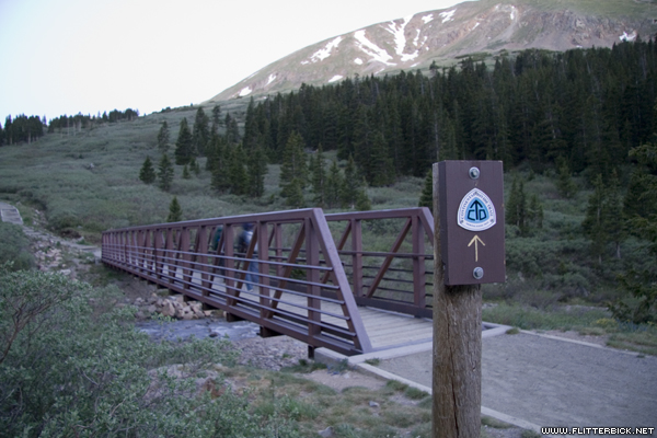
At 5:20am, we started up the the Grays peak trail, a part of the CDT. Grays and Torreys are the only 14ers on the continental divide.
- 17 June 2006
- Canon Rebel XT
- 1/4s f/4.0 at 17mm iso800

Grays comes into view
- 17 June 2006
- Canon Rebel XT
- 1/1000s f/4.5 at 28mm iso800

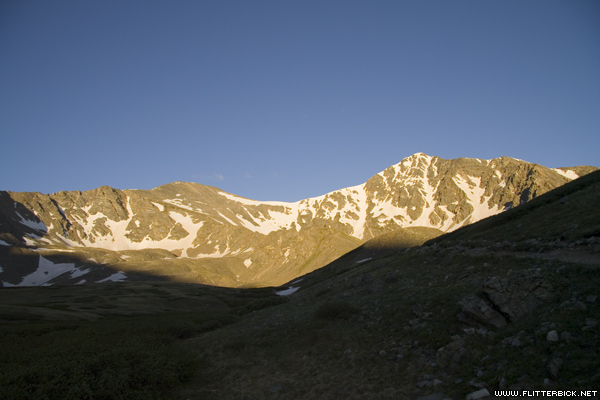
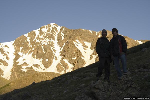
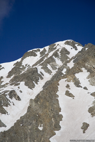
Alpenglow on Torreys peak. We are climbing it via the Kelso ridge, which is on the right side of the photo.
- 17 June 2006
- Canon Rebel XT
- 1/160s f/10.0 at 50mm iso100
Grays and Torreys. Torreys appears bigger, but Grays is actually the taller of the two by a whopping 3 feet
- 17 June 2006
- Canon Rebel XT
- 1/125s f/8.0 at 17mm iso100
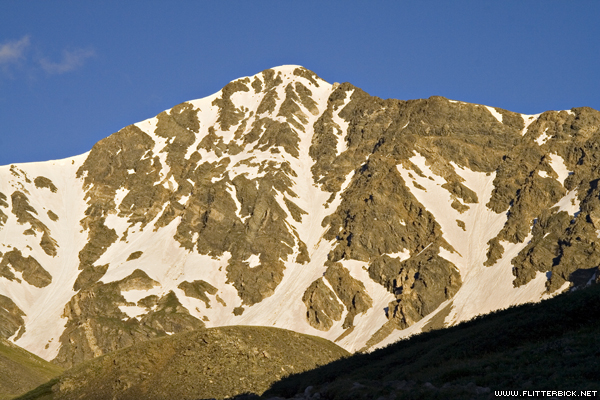
Torreys peak. The prominent finger of snow leading to a point just right of the summit is Dead Dog Couloir, a popular ascent route for the ice axe/crampon types.
- 17 June 2006
- Canon Rebel XT
- 1/160s f/16.0 at 64mm iso200
Pat, Josh, and Torreys peak
- 17 June 2006
- Canon Rebel XT
- 1/125s f/9.0 at 47mm iso200
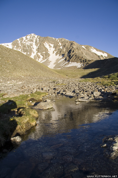
The entire Kelso ridge is visible from this pond.
- 17 June 2006
- Canon Rebel XT
- 1/160s f/9.0 at 17mm iso200
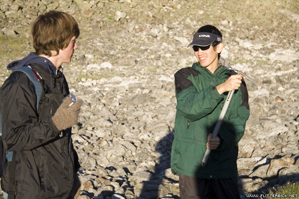
Pat demonstrates proper ice axe usage (neither Josh nor I brought one, though)
- 17 June 2006
- Canon Rebel XT
- 1/250s f/5.6 at 56mm iso200
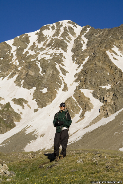
Pat
- 17 June 2006
- Canon Rebel XT
- 1/320s f/13.0 at 59mm iso200
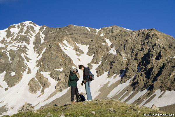
Pat and Josh get ready to leave the main trail and gain the Kelso Ridge, 6:25am
- 17 June 2006
- Canon Rebel XT
- 1/160s f/10.0 at 44mm iso200
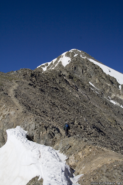
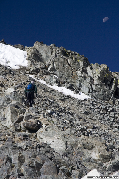
At 6:55am, we were well on our way up the ridge. This section is as hard as it typically got at any one place.
- 17 June 2006
- Canon Rebel XT
- 1/400s f/5.6 at 26mm iso200
Look at the center of this photo and see if you can pick out four climbers in Dead Dog Couloir. They look like small dots, and I'm zoomed all the way in.
- 17 June 2006
- Canon Rebel XT
- 1/1000s f/5.6 at 85mm iso200
8:00am, looking back down at what we've climbed so far. We've been at it a little more than an hour.
- 17 June 2006
- Canon Rebel XT
- 1/125s f/9.0 at 30mm iso200
An easy section near the middle of the Kelso ridge
- 17 June 2006
- Canon Rebel XT
- 1/200s f/11.0 at 30mm iso200

Pat and Josh
- 17 June 2006
- Canon Rebel XT
- 1/250s f/9.0 at 85mm iso200

Pat climbs a slab. This was taken more or less at the 14,000 foot mark.
- 17 June 2006
- Canon Rebel XT
- 1/160s f/9.0 at 38mm iso200
Two climbers finish up the last stretch of Dead Dog Couloir. They said the route was "nice and direct."
- 17 June 2006
- Canon Rebel XT
- 1/250s f/13.0 at 33mm iso200
Pat
- 17 June 2006
- Canon Rebel XT
- 1/320s f/5.6 at 47mm iso200
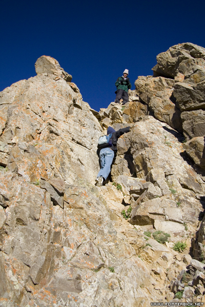
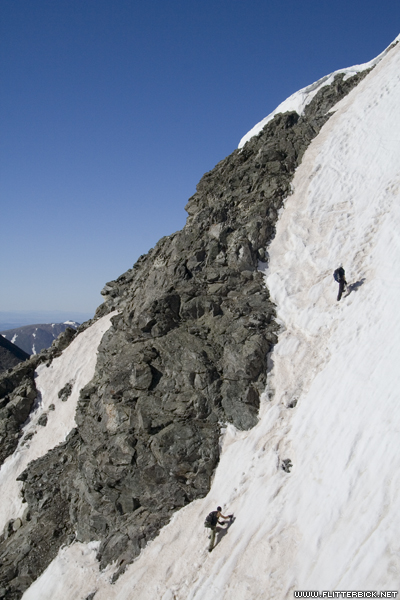
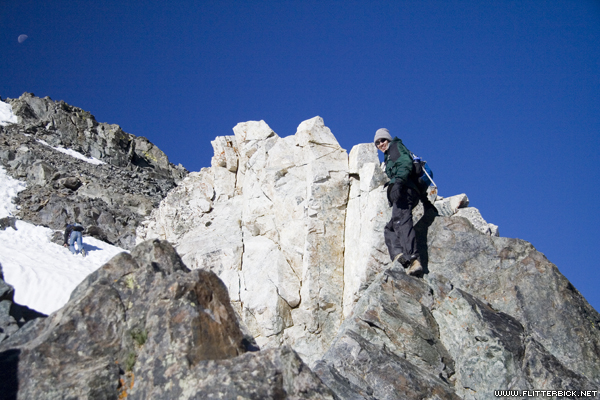
Most guidebooks refer to this section as the most difficult part (but they're just messing with you).
- 17 June 2006
- Canon Rebel XT
- 1/1000s f/5.6 at 35mm iso200
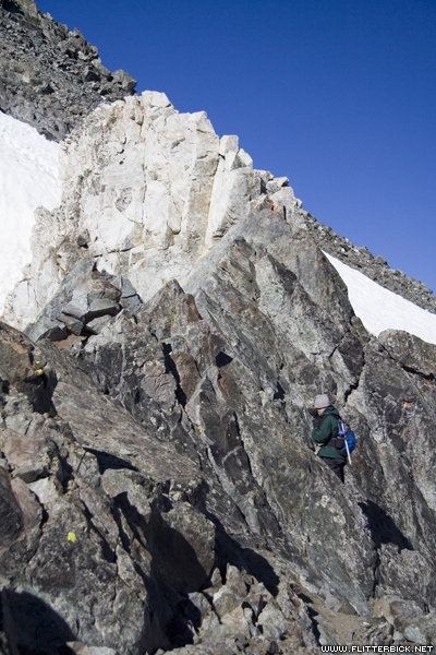
Pat is halfway done. Josh (behind him) is already finished.
- 17 June 2006
- Canon Rebel XT
- 1/1000s f/5.6 at 38mm iso200
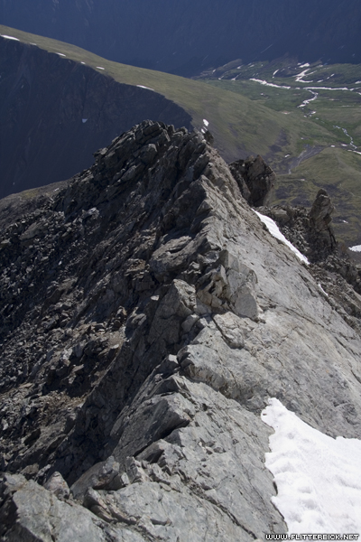
Looking back at the knife-edge that finishes the ridge: Straddle it and scoot along with your hands. It's not hard, but it is exposed.
- 17 June 2006
- Canon Rebel XT
- 1/125s f/9.0 at 26mm iso200
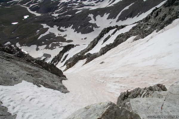
Looking left and down from the knife edge: a drop down Dead Dog Couloir of more than a thousand vertical feet.
- 17 June 2006
- Canon Rebel XT
- 1/400s f/14.0 at 17mm iso200
Looking ahead from the knife edge: Pat hikes the last hundred yards to the summit.
- 17 June 2006
- Canon Rebel XT
- 1/250s f/9.0 at 83mm iso200
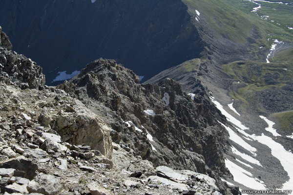
Looking down and right from the knife edge: another thought-provoking scene.
- 17 June 2006
- Canon Rebel XT
- 1/250s f/11.0 at 17mm iso200
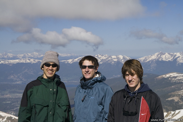
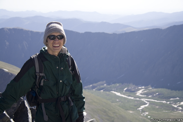
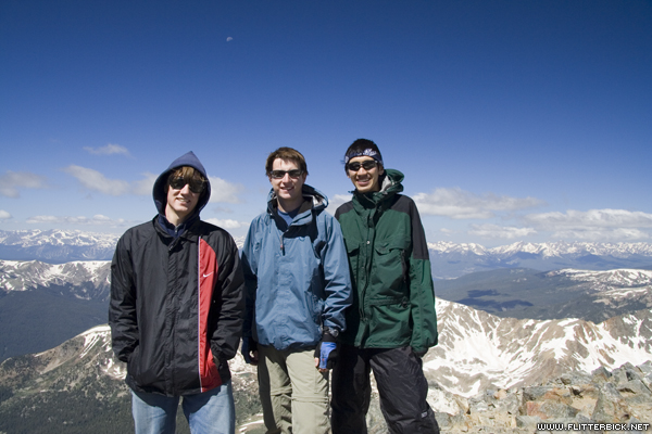
9:00am, on top of Torreys (14,267ft): Pat, me, and Josh
- 17 June 2006
- Canon Rebel XT
- 1/250s f/11.0 at 61mm iso200
Looking over at Grays from Torreys. The trail (the zig-zag on the left side) was absolutely clogged with day hikers by this point (most of whom do Grays before Torreys).
- 17 June 2006
- Canon Rebel XT
- 1/250s f/11.0 at 24mm iso200
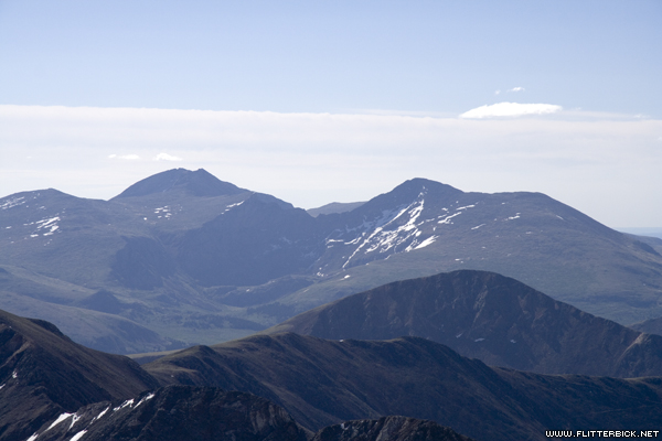
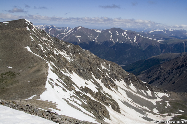
Evans, Bierstadt, and the Sawtooth ridge from Torreys peak. We did that hike two weeks ago.
- 17 June 2006
- Canon Rebel XT
- 1/250s f/9.0 at 85mm iso200
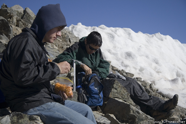
Lunch (at 9 in the morning)
- 17 June 2006
- Canon Rebel XT
- 1/500s f/5.6 at 50mm iso200
An hour later, we are on Grays and the front end of the hiker horde has made it to Torreys (you can see the crowd on top).
- 17 June 2006
- Canon Rebel XT
- 1/250s f/9.0 at 85mm iso200
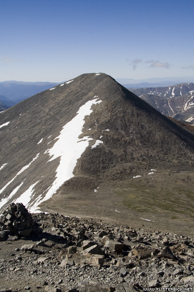
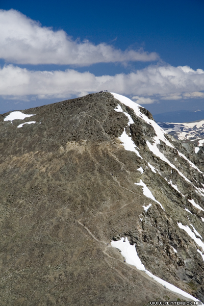
The Kelso ridge, seen from Grays peak
- 17 June 2006
- Canon Rebel XT
- 1/200s f/10.0 at 24mm iso200
Josh, me, and Pat on Grays at 10:20 (14,270ft)
- 17 June 2006
- Canon Rebel XT
- 1/125s f/8.0 at 22mm iso200
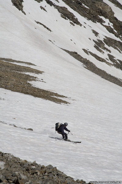
A skier starts down the snowfield between Grays and Torreys. We decided to glissade down after him rather than hike down the crowded trail. (It took us an hour anyway, but it wasn't as boring)
- 17 June 2006
- Canon Rebel XT
- 1/400s f/11.0 at 85mm iso200
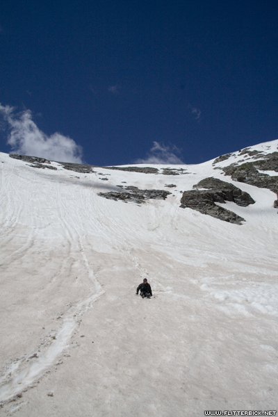
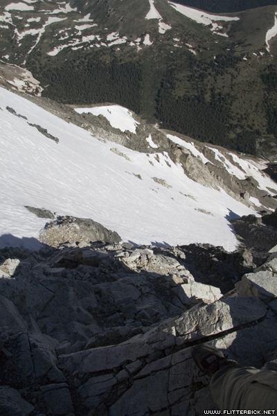
Glissading down into the bowl between Grays and Torreys. Yes, it is MUCH steeper than it looks from here.
- 17 June 2006
- Canon Rebel XT
- 1/400s f/14.0 at 17mm iso400
Pat, with trusty ice axe
- 17 June 2006
- Canon Rebel XT
- 1/320s f/10.0 at 85mm iso400
Josh
- 17 June 2006
- Canon Rebel XT
- 1/250s f/11.0 at 64mm iso400
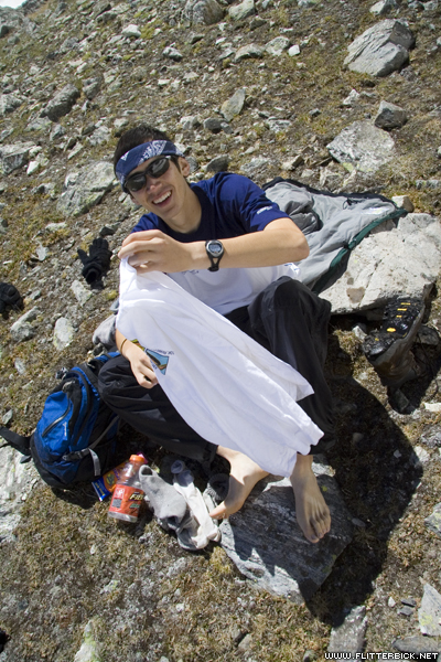
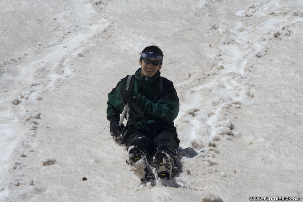
Pat changes socks after the glissade
- 17 June 2006
- Canon Rebel XT
- 1/200s f/10.0 at 17mm iso400
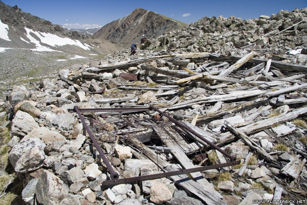
Abandoned mining building at the bottom of the snowfield. Kelso mountain is in the background.
- 17 June 2006
- Canon Rebel XT
- 1/250s f/11.0 at 17mm iso400

Back at the truck at 1pm (an 8 hour round trip).
- 17 June 2006
- Canon Rebel XT
- 1/125s f/8.0 at 22mm iso400