Our goal was the summit of Navajo peak, the range's third-highest. We hiked up the Pawnee pass trail from the Brainard lake rec area, past Long Lake and Lake Isabelle, and continued off-trail to the base of the Isabelle glacier. From here we worked our way to the scree gully below Navajo.
The wreckage of a C-47 airplane, which crashed here in 1948, lies scattered in the gully. One wing of the plane lies at the bottom, and the rest of the wreckage is located a 500-foot scree climb above, near where the gully reaches the Niwot ridge. We ascended this gully, past the airplane debris, to the ridgeline. The route then wraps around the back of Navajo and climbs to the summit. The scrambling was all pretty straightforward, though there are scary-looking precipices throughout.
The entire mountain was shrouded in fog while we were on it, so the drop-offs appeared to have no bottom and there was no view from the summit. Luckily, it did not rain, so we were spared another continuous cold shower such as the one we had on Longs a few weeks before. Lauren and I had some difficulty with the fog on the way down, while we were trying to find out how to get back to the ridge. Dramatically and seemingly instantly, the cloud lifted from the basin below us and revealed the ridge to our left. It literally changed from an opaque fog to airy sunshine in the span of a few seconds- which I thought was pretty cool.

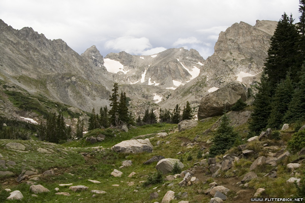
Leaving from the Brainard Lake recreation area
- 6 August 2006
- Canon Rebel XT
- 1/60s f/6.3 at 33mm iso1600
The Indian Peaks wilderness: Navajo peak (left) and Apache peak.
- 6 August 2006
- Canon Rebel XT
- 1/125s f/8.0 at 30mm iso200
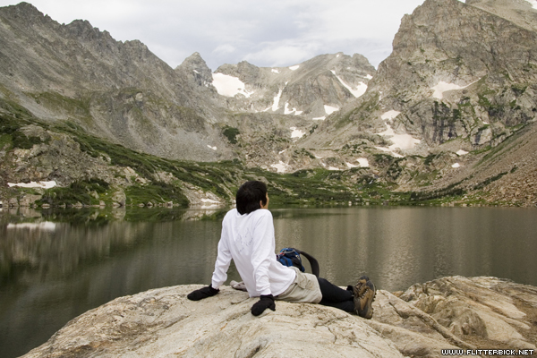
Taking a break at Lake Isabelle
- 6 August 2006
- Canon Rebel XT
- 1/125s f/8.0 at 64mm iso200
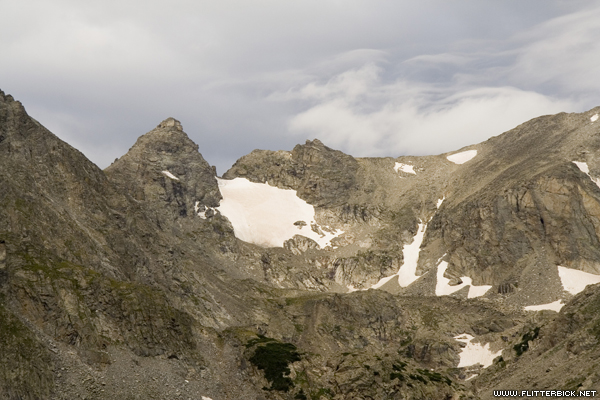
Navajo Peak (left)
- 6 August 2006
- Canon Rebel XT
- 1/200s f/10.0 at 68mm iso200
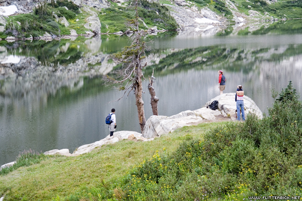
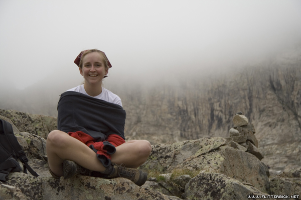
Pat at Lake Isabelle
- 6 August 2006
- Canon Rebel XT
- 1/160s f/10.0 at 26mm iso200

Pat, Jackie and Lauren
- 6 August 2006
- Canon Rebel XT
- 1/125s f/8.0 at 24mm iso200

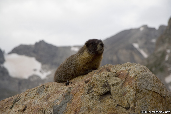
Marmots
- 6 August 2006
- Canon Rebel XT
- 1/400s f/5.6 at 83mm iso200
I think this one looks like Pat.
- 6 August 2006
- Canon Rebel XT
- 1/500s f/5.6 at 85mm iso200
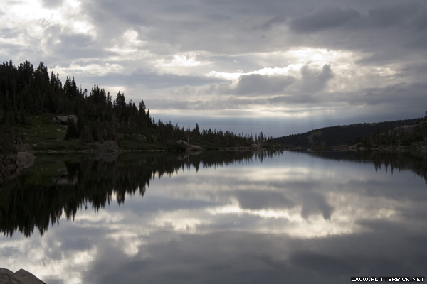
Lake Isabelle
- 6 August 2006
- Canon Rebel XT
- 1/200s f/11.0 at 47mm iso200
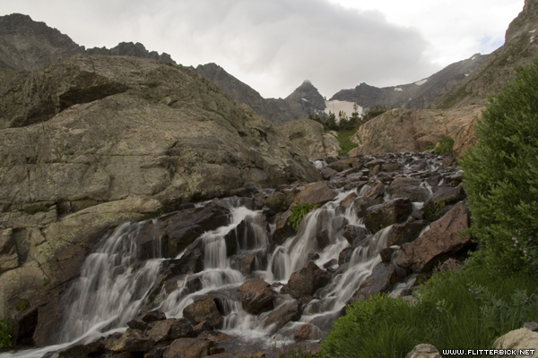
Waterfall above Lake Isabelle
- 6 August 2006
- Canon Rebel XT
- 1/6s f/20.0 at 20mm iso100
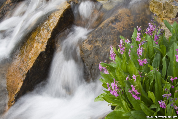
Waterfall above Lake Isabelle
- 6 August 2006
- Canon Rebel XT
- 1/4s f/18.0 at 30mm iso100

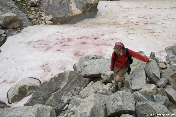
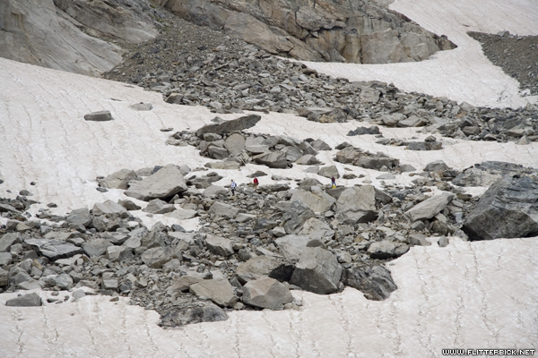
Pat looks for a way across the moraine field.
- 6 August 2006
- Canon Rebel XT
- 1/250s f/4.0 at 22mm iso100
Clouds settled in midway through the morning- but it didn't rain.
- 6 August 2006
- Canon Rebel XT
- 1/125s f/9.0 at 26mm iso100
Pat
- 6 August 2006
- Canon Rebel XT
- 1/400s f/5.6 at 66mm iso100
Jackie
- 6 August 2006
- Canon Rebel XT
- 1/320s f/5.6 at 59mm iso100
Jackie
- 6 August 2006
- Canon Rebel XT
- 1/200s f/9.0 at 20mm iso100
Pat, Jackie and Lauren took the high road while I kept low and tried to take pictures of pikas.
- 6 August 2006
- Canon Rebel XT
- 1/100s f/6.3 at 83mm iso100
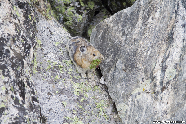
Pika with a snack
- 6 August 2006
- Canon Rebel XT
- 1/500s f/5.6 at 85mm iso800

Pika with a snack
- 6 August 2006
- Canon Rebel XT
- 1/400s f/5.6 at 85mm iso800
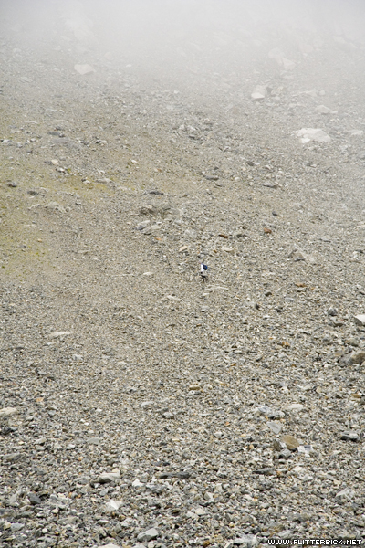
Pat on the scree field beneath airplane gully
- 6 August 2006
- Canon Rebel XT
- 1/400s f/5.6 at 83mm iso400
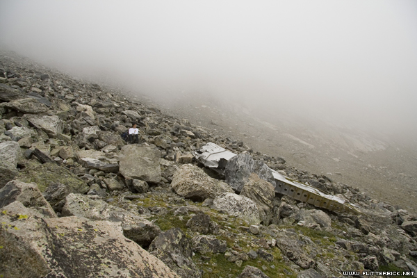
Pat and an airplane wing at the bottom of the gully
- 6 August 2006
- Canon Rebel XT
- 1/125s f/8.0 at 17mm iso200
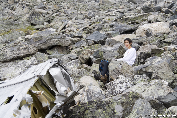
Pat and an airplane wing
- 6 August 2006
- Canon Rebel XT
- 1/100s f/8.0 at 47mm iso200

Plane engine
- 6 August 2006
- Canon Rebel XT
- 1/100s f/7.1 at 17mm iso200
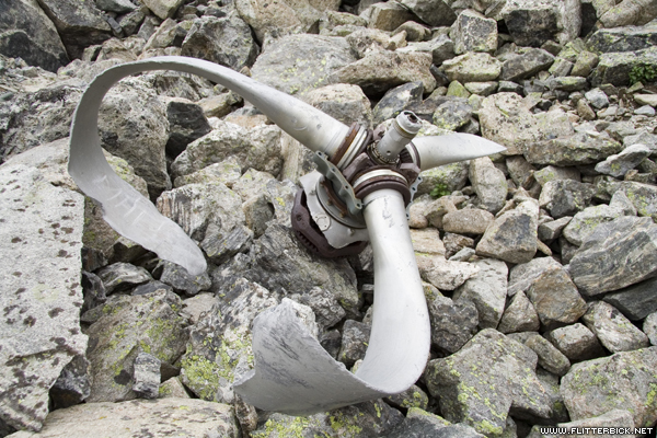
Propeller
- 6 August 2006
- Canon Rebel XT
- 1/100s f/7.1 at 20mm iso200
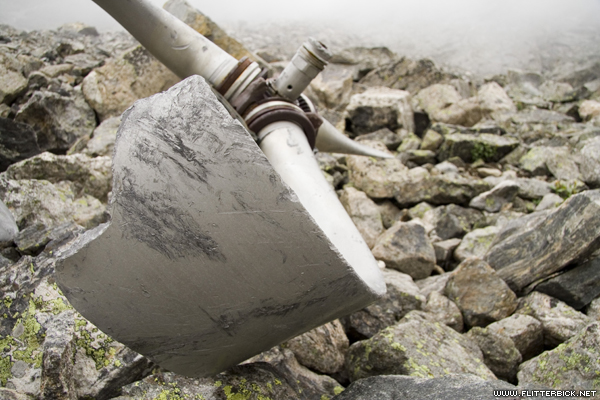
Propeller
- 6 August 2006
- Canon Rebel XT
- 1/160s f/5.6 at 20mm iso200
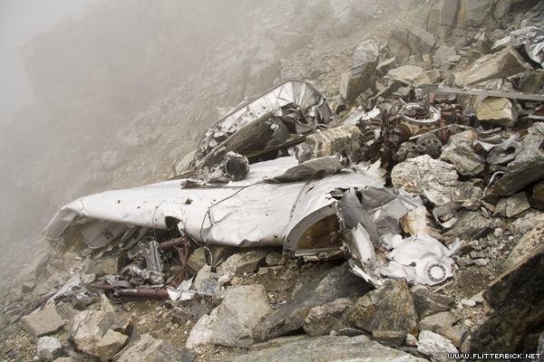
The other half of the plane sits at the top of the gully, a steep scree climb up.
- 6 August 2006
- Canon Rebel XT
- 1/400s f/5.6 at 17mm iso200
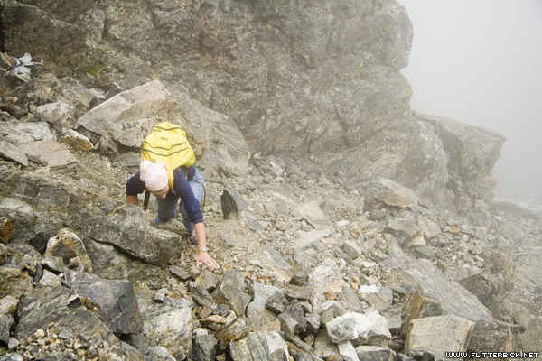
Lauren climbs the last bit out of the airplane gully
- 6 August 2006
- Canon Rebel XT
- 1/320s f/5.6 at 35mm iso200
Lauren reaches the ridgeline of Navajo Peak
- 6 August 2006
- Canon Rebel XT
- 1/800s f/5.6 at 20mm iso200
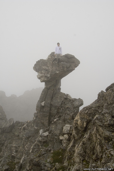
Pat climbs a weird rock formation (not the Dicker's peck) near the summit of Navajo.
- 6 August 2006
- Canon Rebel XT
- 1/250s f/13.0 at 33mm iso200

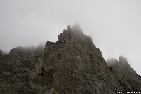
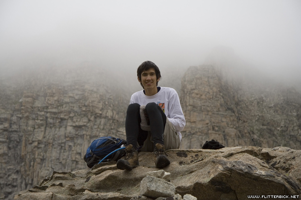
Self-portrait on the summit. The summit was in a cloud, so there were no views to be had.
- 6 August 2006
- Canon Rebel XT
- 1/320s f/13.0 at 17mm iso200

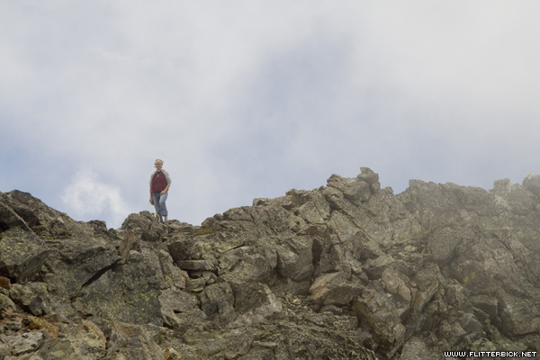
I was too much of a pansy to climb this thing like Pat did (there's a large cliff a foot or two behind me).
- 6 August 2006
- Canon Rebel XT
- 1/250s f/11.0 at 61mm iso200
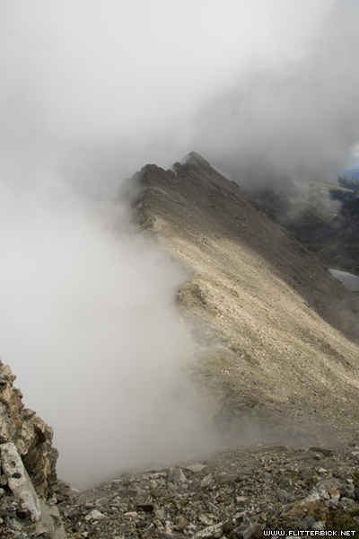
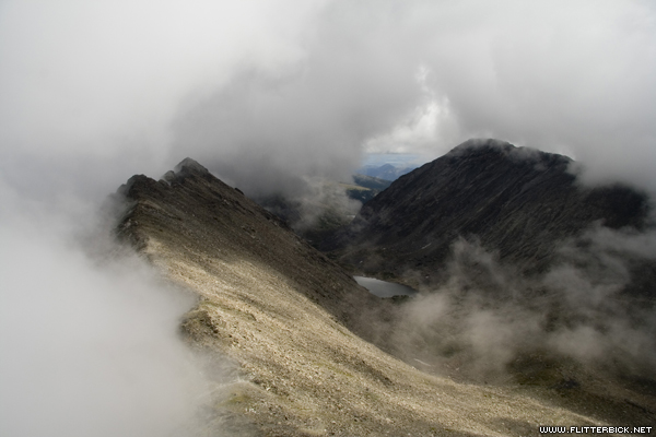
Clouds clear from the ridgeline during the descent.
- 6 August 2006
- Canon Rebel XT
- 1/320s f/13.0 at 17mm iso200
We came up onto this ridgeline from the right. The other side is the City of Boulder watershed, which is off limits to hikers.
- 6 August 2006
- Canon Rebel XT
- 1/250s f/11.0 at 17mm iso200
Lauren
- 6 August 2006
- Canon Rebel XT
- 1/200s f/10.0 at 68mm iso200

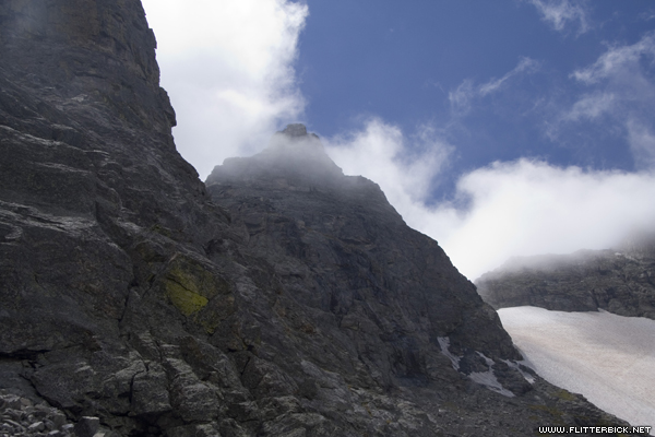
Clouds clear briefly from the summit of Navajo, seen from the top of Airplane gully.
- 6 August 2006
- Canon Rebel XT
- 1/160s f/9.0 at 17mm iso200

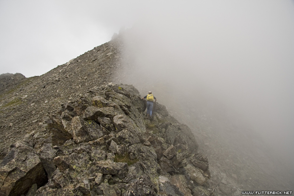
Lauren descends the gully
- 6 August 2006
- Canon Rebel XT
- 1/60s f/6.3 at 38mm iso200
Clouds clear from Navajo, seen from the bottom of the gully.
- 6 August 2006
- Canon Rebel XT
- 1/125s f/9.0 at 28mm iso200

I believe this formation is called "the chessmen."
- 6 August 2006
- Canon Rebel XT
- 1/25s f/22.0 at 20mm iso200
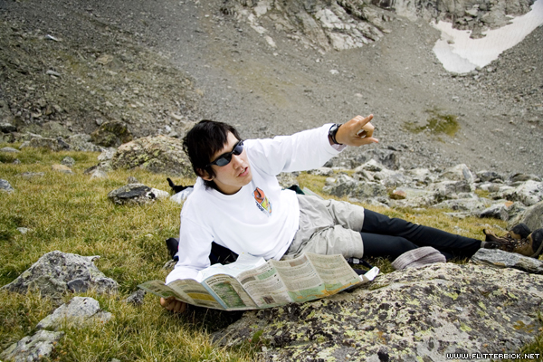
Pat identifies nearby summits
- 6 August 2006
- Canon Rebel XT
- 1/200s f/4.0 at 20mm iso100
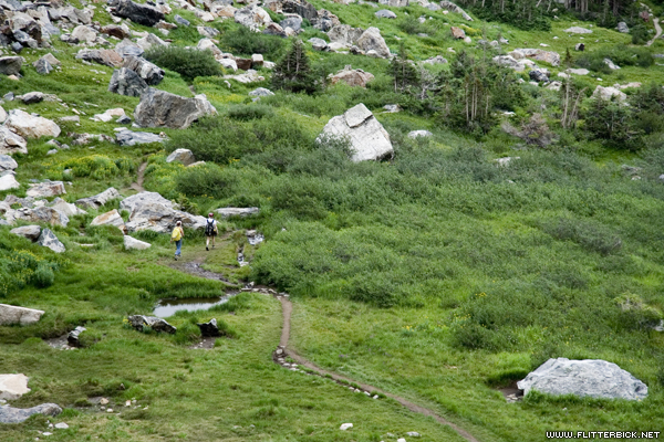
Hiking back to the truck
- 6 August 2006
- Canon Rebel XT
- 1/100s f/5.6 at 85mm iso100
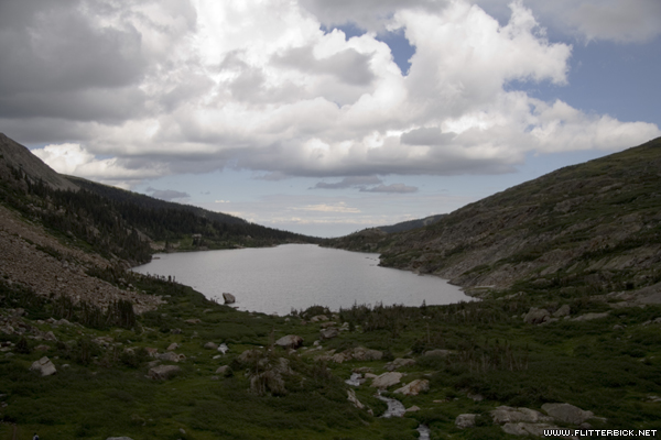
Lake Isabelle
- 6 August 2006
- Canon Rebel XT
- 1/640s f/4.5 at 26mm iso100